
Route Fremantle - Abrolhos (Inselgruppe) - Abrolhos (Inselgruppe) - Kap Peron, Haifischbucht - Nördliche Muiron-Insel - Montebello Inseln - Dampier Archipel, Australien - Auf hoher See - Adele Island, Neuseeland - Buccaneer Archipelago Mehr
Coming in at number seven on Lonely Planet’s list of best places to live, Fremantle has finally begun to shake off the shadow of neighbouring big brother Perth. With just 20 kilometres separating the two cities, Perth, with its happy hippie vibe has long been the big pull for visitors to the region. But Fremantle’s colourful past and bright future gives Perth as good as it gets. The coastal city has undergone a complete revamp since the America’s Cup thrust Fremantle into the spotlight in 1987. Over AUS$ 1,3 billion has been poured into revamping the city, and the fruits of the city’s labour are ripe for picking. Investment in the arts has brought Fremantle to the fore of thriving urban culture, while generous grants for small businesses has led to groovy live-music rooms, hipster bars, boutique hotels, left-field bookshops, craft-beer breweries, Indian Ocean seafood shacks amid the buskers and beaches. If that doesn’t not sound like your glass of beer, we guarantee a stroll along the wooden riverside walkway will change your mind. The city also enjoys another, rather different status. Fremantle was one of Australia’s penal cities, vestiges of which can still be found in Fremantle Prison. Almost 10,000 convicts were condemned to life imprisonment here between 1850 and 1868, but the prison remained in use until 1991. Today, the memorable sandstone building is a UNESCO World Heritage Site and at just 15 minutes from port is well worth a visit. Just don’t forget your get out of jail free card.
Three island groups make up the Houtman Abrolhos Islands. The Wallabi, Easter and Pelsaert groups stretch across 100 kilometers from north to south with a total of 122 islands. Named Houtman after the Dutch captain who first described them in 1619, the Portuguese word “Abrolhos” refers to the reefs and dangers they posed to unsuspecting seafarers –sometimes taken to mean “open your eyes”. The Houtman Abrolhos are known for cray fishing and pearling activities, as well as for their bird and marine life. The islands and their surrounding reef communities form one of Western Australia’s unique marine areas of tropical and temperate sea life.
Three island groups make up the Houtman Abrolhos Islands. The Wallabi, Easter and Pelsaert groups stretch across 100 kilometers from north to south with a total of 122 islands. Named Houtman after the Dutch captain who first described them in 1619, the Portuguese word “Abrolhos” refers to the reefs and dangers they posed to unsuspecting seafarers –sometimes taken to mean “open your eyes”. The Houtman Abrolhos are known for cray fishing and pearling activities, as well as for their bird and marine life. The islands and their surrounding reef communities form one of Western Australia’s unique marine areas of tropical and temperate sea life.
Adele Island is an island located in the Indian Ocean approximately 104 kilometres North of Ardyaloon off the Kimberley coast in Western Australia
Set off the coast of Western Australia, the Buccaneer Archipelago is one of the Kimberley’s finest secrets. The Archipelago, 50 k2 (19 sq mi), is made up of around 800 islands and protect the mainland from the huge 12 metre tides and astonishing speed of the Yampi (or, in traditional Aborigine, “Yampee”) Sound. The speed and power of the water many not make for pleasant bathing, but do however result in fantastic natural phenomena. One fine example is the horizontal reversible waterfall in Talbot Bay. The tidal pull is responsible for the “reversible” nature of the falls, however, this also hides narrow gaps between the islands, making for treacherous sailing conditions. Isolated graves of sailors and divers are testimony to the danger. William Dampier sighted the Archipelago in 1688 but it would not be until 1821 that the Archipelago would become known as Buccaneer (a term coined by Captain Phillip Parker King) „in commemoration of William Dampier’s visit to this part of the coast „. Commander John Lort Stokes also noted the area in his 1838 record. Enterprising individuals were initially attracted to the Buccaneer Archipelago in the 1800s due to the superior pearling as well as the rich iron ore deposits. Pearling conducted by luggers in the 1880s was concentrated in Cygnet Bay, Cascade Bay, Cone Bay and Strickland Bay. More recently, mining operators established open-cut mines on Koolan Island on the east side of the Sound. Some of the richest iron ore in the world is extracted here to this day.
Set off the coast of Western Australia, the Buccaneer Archipelago is one of the Kimberley’s finest secrets. The Archipelago, 50 k2 (19 sq mi), is made up of around 800 islands and protect the mainland from the huge 12 metre tides and astonishing speed of the Yampi (or, in traditional Aborigine, “Yampee”) Sound. The speed and power of the water many not make for pleasant bathing, but do however result in fantastic natural phenomena. One fine example is the horizontal reversible waterfall in Talbot Bay. The tidal pull is responsible for the “reversible” nature of the falls, however, this also hides narrow gaps between the islands, making for treacherous sailing conditions. Isolated graves of sailors and divers are testimony to the danger. William Dampier sighted the Archipelago in 1688 but it would not be until 1821 that the Archipelago would become known as Buccaneer (a term coined by Captain Phillip Parker King) „in commemoration of William Dampier’s visit to this part of the coast „. Commander John Lort Stokes also noted the area in his 1838 record. Enterprising individuals were initially attracted to the Buccaneer Archipelago in the 1800s due to the superior pearling as well as the rich iron ore deposits. Pearling conducted by luggers in the 1880s was concentrated in Cygnet Bay, Cascade Bay, Cone Bay and Strickland Bay. More recently, mining operators established open-cut mines on Koolan Island on the east side of the Sound. Some of the richest iron ore in the world is extracted here to this day.
Set off the coast of Western Australia, the Buccaneer Archipelago is one of the Kimberley’s finest secrets. The Archipelago, 50 k2 (19 sq mi), is made up of around 800 islands and protect the mainland from the huge 12 metre tides and astonishing speed of the Yampi (or, in traditional Aborigine, “Yampee”) Sound. The speed and power of the water many not make for pleasant bathing, but do however result in fantastic natural phenomena. One fine example is the horizontal reversible waterfall in Talbot Bay. The tidal pull is responsible for the “reversible” nature of the falls, however, this also hides narrow gaps between the islands, making for treacherous sailing conditions. Isolated graves of sailors and divers are testimony to the danger. William Dampier sighted the Archipelago in 1688 but it would not be until 1821 that the Archipelago would become known as Buccaneer (a term coined by Captain Phillip Parker King) „in commemoration of William Dampier’s visit to this part of the coast „. Commander John Lort Stokes also noted the area in his 1838 record. Enterprising individuals were initially attracted to the Buccaneer Archipelago in the 1800s due to the superior pearling as well as the rich iron ore deposits. Pearling conducted by luggers in the 1880s was concentrated in Cygnet Bay, Cascade Bay, Cone Bay and Strickland Bay. More recently, mining operators established open-cut mines on Koolan Island on the east side of the Sound. Some of the richest iron ore in the world is extracted here to this day.
The Hunter River is home to an immense mangrove system surrounded by soaring red sandstone cliffs. Narrow mangrove channels shelter numerous bird species, mudskippers, fiddler crabs and the infamous saltwater crocodile; the most aggressive crocodile species known to man. Naturalist Island at the mouth of the river has a stunning stretch of sandy beach that makes a perfect landing site for small helicopters that can pick up visitors wishing to explore some of the Kimberley’s vast interior. View less The highlight inland is the famous Mitchell Falls where four tiers of waterfalls plunge into deep pools that flow out into the mighty Mitchell River. The headwaters of the falls are cool and a dip in the fresh water is a welcome reprieve from the heat of the heartland.
The Territory of Ashmore and Cartier Islands is an uninhabited external territory of Australia consisting of four low-lying tropical islands in two separate reefs, and the 12-nautical-mile territorial sea generated by the islands
Darwin liegt in der oberen Hälfte des Northern Territory, ein Landstrich, der von der restlichen Nation durch tausende Kilometer karger Wüste getrennt wird. Dies ist das Land von Crocodile Dundee, mit Darwin als seiner Vorzeigestadt. Dieses Land der Extreme hat nur zwei Jahreszeiten: trocken und nass, oder besser gesagt Dürre und Sintflut. Letzt Genanntes ist außerdem ein Merkmal seiner Bewohner; der durchschnittliche Einwohner konsumiert angeblich mindestens 227 Liter Bier pro Jahr. Die Stadt wurde nach dem Naturforscher Charles Darwin benannt, der auf seiner historischen Reise auf der M.S. Beagle hier Halt gemacht hat. Während des Zweiten Weltkrieges spielte Darwin als ein wichtiger Militärhafen der Alliierten eine signifikante Rolle und musste unzählige Bombenattacken der Japaner ertragen. Im Dezember 1974 wurde die Stadt von einigen heftigen und grausamen Zyklonen heimgesucht, die fast 60 Prozent der Gebäude zerstörten.
Darwin liegt in der oberen Hälfte des Northern Territory, ein Landstrich, der von der restlichen Nation durch tausende Kilometer karger Wüste getrennt wird. Dies ist das Land von Crocodile Dundee, mit Darwin als seiner Vorzeigestadt. Dieses Land der Extreme hat nur zwei Jahreszeiten: trocken und nass, oder besser gesagt Dürre und Sintflut. Letzt Genanntes ist außerdem ein Merkmal seiner Bewohner; der durchschnittliche Einwohner konsumiert angeblich mindestens 227 Liter Bier pro Jahr. Die Stadt wurde nach dem Naturforscher Charles Darwin benannt, der auf seiner historischen Reise auf der M.S. Beagle hier Halt gemacht hat. Während des Zweiten Weltkrieges spielte Darwin als ein wichtiger Militärhafen der Alliierten eine signifikante Rolle und musste unzählige Bombenattacken der Japaner ertragen. Im Dezember 1974 wurde die Stadt von einigen heftigen und grausamen Zyklonen heimgesucht, die fast 60 Prozent der Gebäude zerstörten.
Mit 20 brandneuen Zodiacs, vier superlativen Restaurants und einer Expeditionsroute von Pol zu Pol bricht die Silver Cloud wirklich das Eis zwischen Expedition und Luxus.
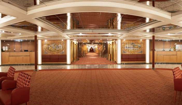
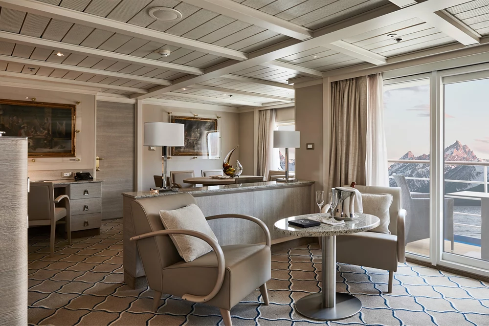
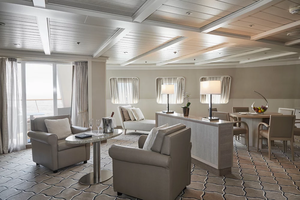
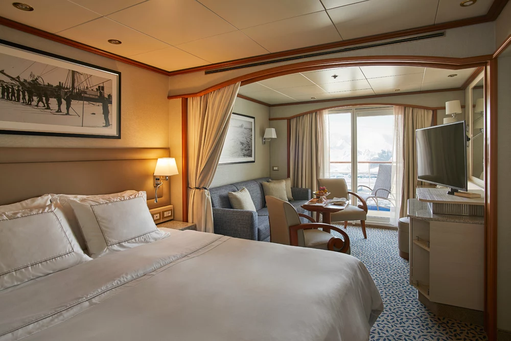
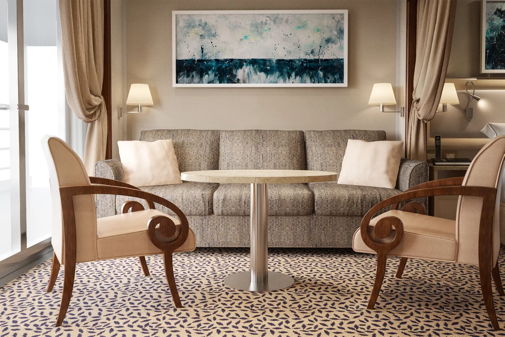
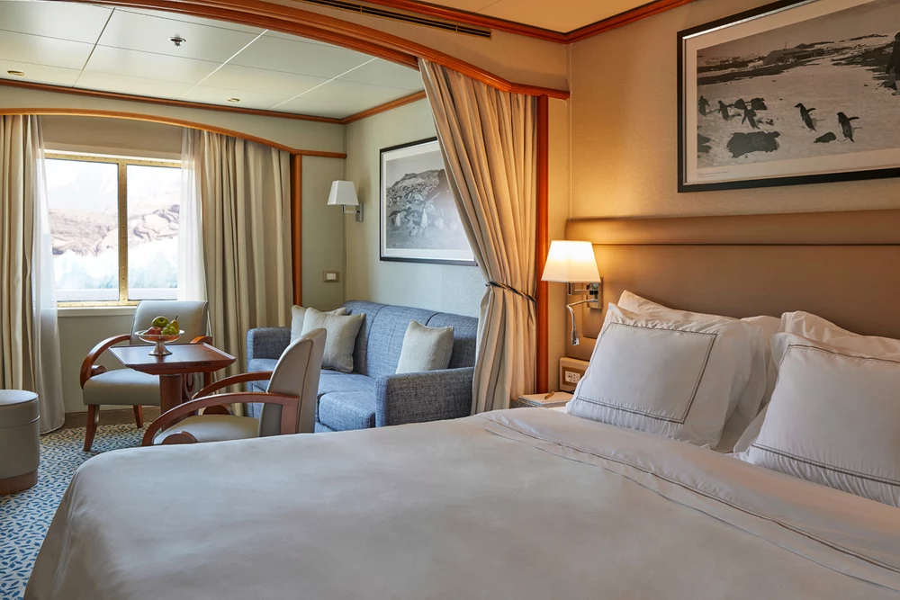
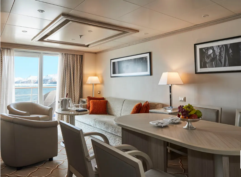
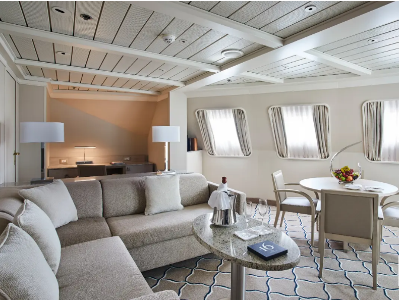
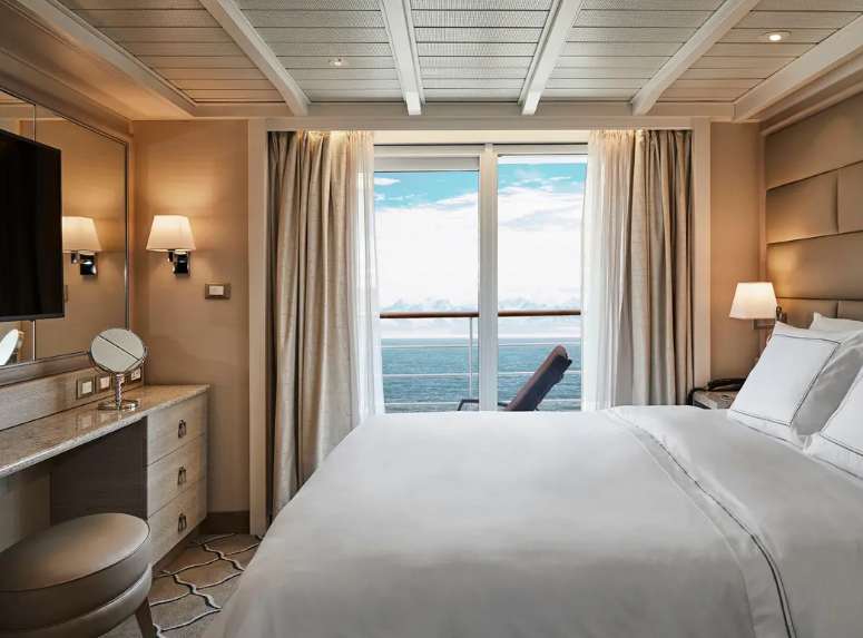
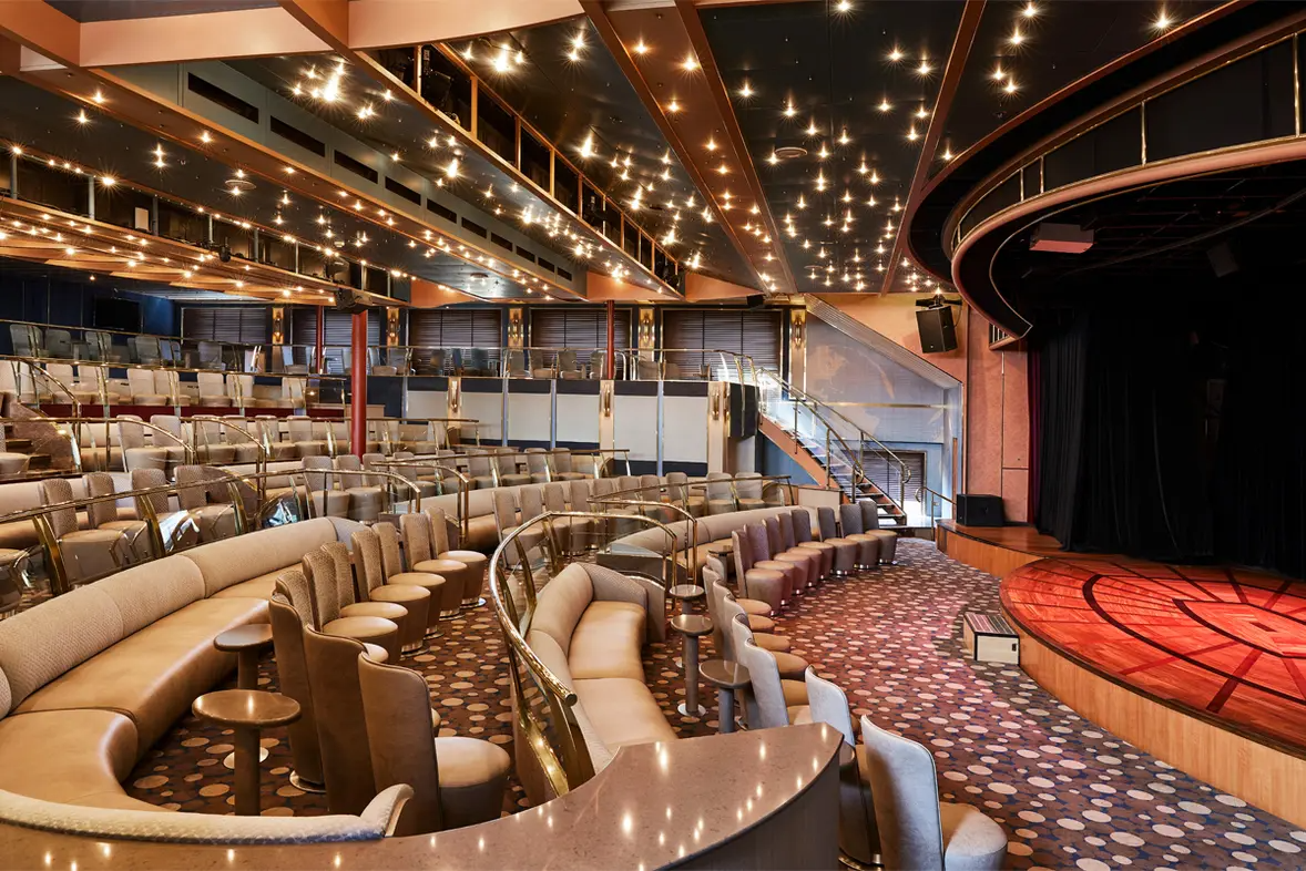
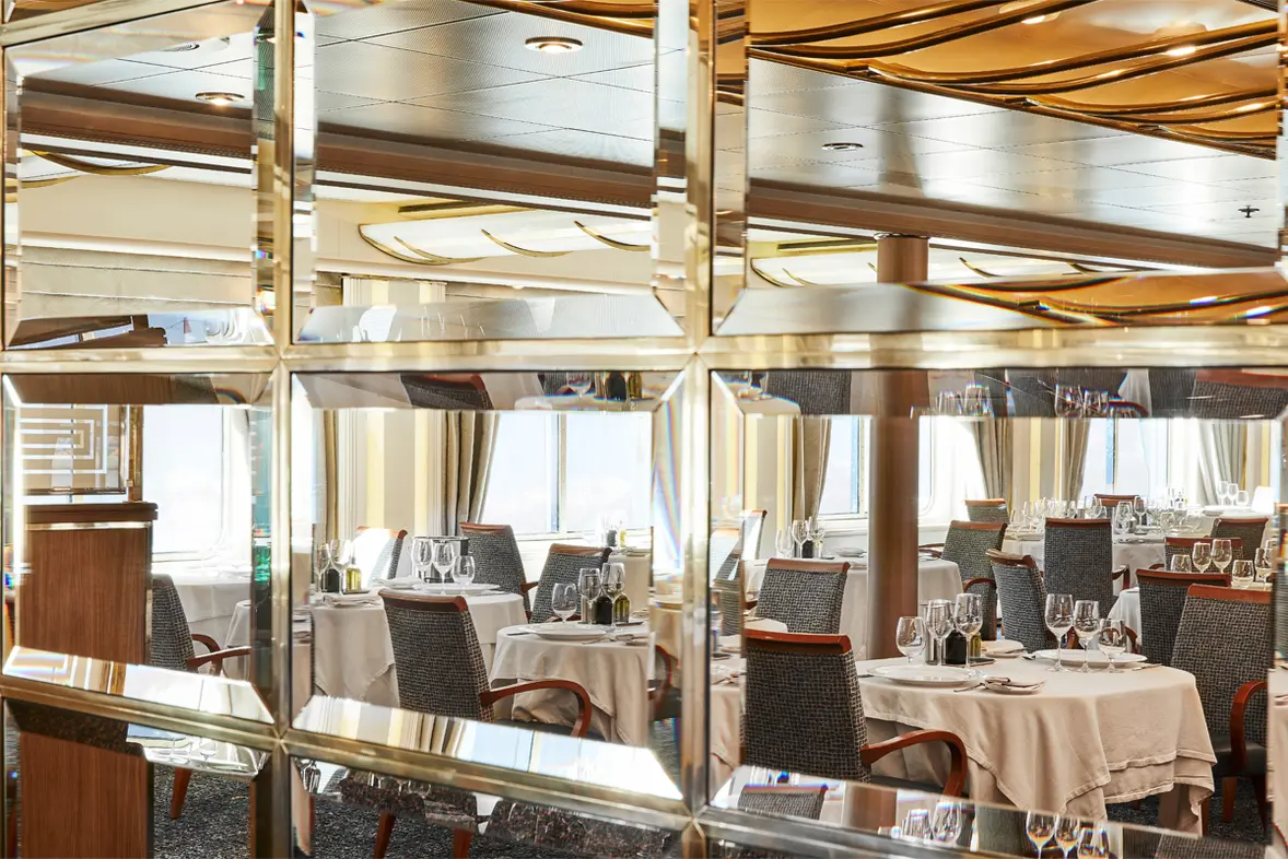
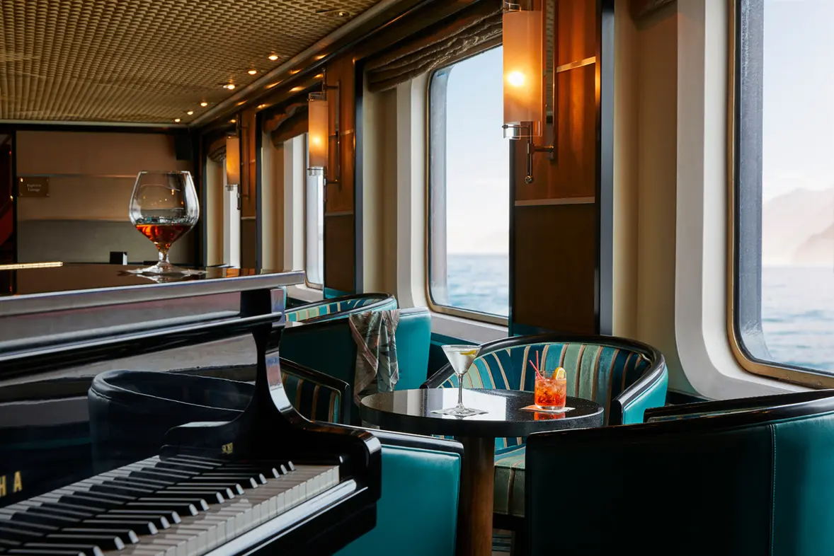
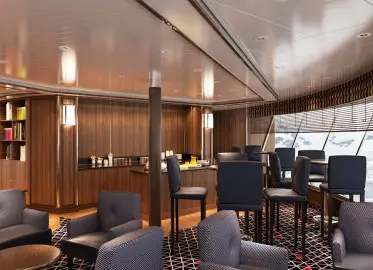
Nach Abschluss der umfangreichen Modernisierungsarbeiten ist die Silver Cloud das wohl geräumigste und komfortabelste Expeditions-Kreuzfahrtschiff mit Eisklasse sein. Die grossen Suiten, einzigartigen Reiserouten und ein beispielloser Service an Bord zeichnen dieses Meisterwerk des Schiffsbau aus. 4 Restaurants verwöhnen Sie mit einem vielfältigen kulinarischen Angebot. Zudem verfügen die meisten Suiten über eine private Veranda, von der Sie in aller Ruhe Wale oder Pinguine beobachten können. Dank der geringen Anzahl an Gästen, bietet die Silver Cloud das grösstmögliche Platzangebot pro Gast sowie das höchste Gäste-Crew-Verhältnis auf Expeditionsschiffen. 20 hochmoderne Zodiacs® ermöglichen gleichzeitige Erkundungen mit allen Gästen an Bord.
Schönheitssalon
Tages-Spa & Fitness-Center
Jacuzzi
Panoramic Lounge
Pool-Deck
Spa
Schwimmbad
Whirlpool
Fitness-Center
Joggingstrecke
Pool
Wellness Center
Arts Cafe
Atlantide
Dolce
La Dame
La Terrazza
Spaccanapoli
The Grill
Venetian
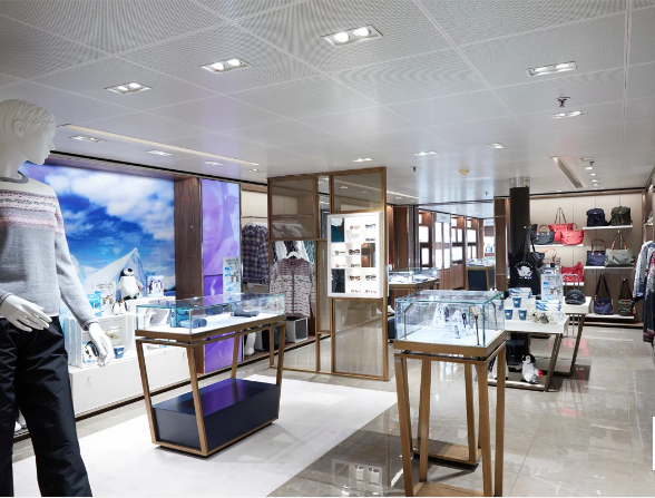
Boutique
Casino
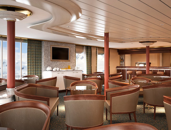
Connoisseur Club
Connoisseur’s Corner
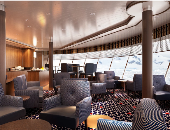
Observation Lounge
Panorama-Lounge
Silver Note
17 Nächte mit der Silver Cloud - - Abfahrt 20.08.2026
![]()

![]()
Vielen Dank für Ihre Anfrage. Sie werden von uns so schnell wie möglich eine entsprechende Offerte erhalten. Beste Grüsse Ihr Cruisetour-Team